![]()
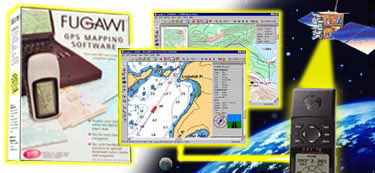
FUGAWI GPS MAPPING SOFTWARE
Fugawi is affordable, feature-packed software that locates your exact position on land or sea.
FUGAWI is a complete navigational system that makes powerful use of the extraordinary GLOBAL POSITIONING SYSTEM (GPS). With FUGAWI, you easily create accurate digital maps from any scanned map or existing map database (ie. BSB MARINE CHARTS or USGS TOPOGRAPHIC MAPS). Then, in real-time navigation mode, your exact position is displayed on the map as you move and new maps are automatically loaded as you travel to new areas. North American customers receive detailed street maps of Canada and USA as well as the nautical Region 1 Planning Charts on CD.
FUGAWI also brings you all the convenience of computer mapping without having to carry it on your travels. You simply position waypoints and routes on your map with a click of the mouse and then upload them to your GPS receiver for use out in the field. Upon returning to your base, you can download added waypoints, routes and tracks onto the digital maps for analysis.
New Feature: Fugawi can upload any map from your PC to a Pocket PC (such as an iPAQ) or a Palm device (OS 3.5+) including the Garmin iQue. Just select an area of a map and press a button. Fugawi does the rest. Enjoy compact real-time GPS navigation with your Pocket PC or Palm. Fugawi also synchronizes waypoints, routes and tracks with the Palm or Pocket PC!